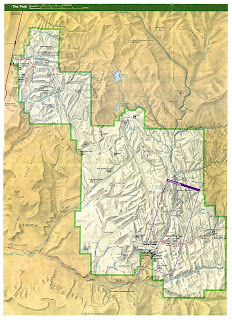
Saturday, 29 May 2010

Day 5 Kayenta AZ to Moab UT


Today we set off from Kayenta at 7am and after a short drive we made it to Monument Valley, a truly beautiful array of mesas, buttes and pinnacles which glow red in the desert sun.

The most prominent statigraphical layer in Monument Valley is 260 million year old Permian De Chelley Sandstone, which form the steep red cliffs that are iconic of this landscape. The buttes and mesas exist due to the hard cap rocks that cover their tops. These prevent erosion of the softer Moenkopi mudstone, Kaibab Limestone (the two thin layers above the De Chelley) and the sloping Organ Rock Shale beneath it. Desert climates in the region throughout the Quaternary have helped accentuate the bare rock landforms.

Monument Valley lies within the Navajo Nation and has been managed as a Tribal Park since 1958, meaning it is not part of a network of Parks managed nationally. The Navajo regard Monument Valley as sacred and it is known as Tse Bii' Ndzisgai in the native Navajo language.

Resources for visitors include a 17 mile valley drive on an unpaved dirt road (source: Monument Valley Leaflet). The main management challenges are posed by the impacts concerned with tourism. The noise from engines of vehicles and the dust from road construction are damaging the landscape (Source: Monument Valley Visitor Centre). Equally another challenge is posed in the form of trying to prevent visitors from carving their names into rocks, as was evident in several of the walls at the visitor centre.

Other guidelines for visitor conduct in the park in the general information of the visitor leaflets include; no rock climbing, no alcohol, keeping pets on leashes and staying on the designated routes.

When entering the park, tourists pay a $5 entrance fee per person, and can camp for as little as $2 per night. A complex of facilities available for tourists include a car park, hotel, restaurant, "trading post" (souvenir shop) and visitor centre.


Within the park, a short distance from the visitor centre lies Gouldings Lodge. It was established in 1924 as a trading post by Harry and Leone 'Mike' Goulding. They were sheep herders from Durango, Colorado whose new homestead established trading links with the Navajo people in the area and they settled in well with the locals. During the great depression they gained fame for Monument Valley and a good deal of respect for themselves by introducing Hollywood to the Valley and starting the series of films shot on location there that continue to impress people through the big screen to this day.


Today the Gouldings are no longer with us but the lodge has been developed to stand as a testimony to them, the lifestyle and artefacts of them and their Navajo friends and neighbours, the movies that were made there and some of the other characters that were attracted to the valley, such as the photographer Josef Muench. Visitors can see these exhibits and also eat, shop and stay at the lodge.

We then moved on to Gooseneck's State Park, where the San Juan River (a tributary of the Colorado), wends its way through a deeply carved river bed.


The Colorado Plateau was uplifted in a period of time known as the Laramide, about 65 million years ago. The upwarp occured so that the plateau was uplifted in a gentle bean-like shape. This gave the San Juan River the ability to cut deeply into the rocks, forming entreched or incised meanders.

At the top, the elevation is 4,971 feet. Looking down on the river from above, the rock type is of the Honaker Trail Formation, which forms the more gentle slopes at the top. Below, the vertical cliffs belong to the Paradox formation, and at the very bottom the San Juan wends its way in sharp S-shaped bends through this Pennsylvanian age rock.

Gooseneck's is managed as a state park by the state of Utah. It is free to enter by a special access road. Tourist facilities are present here, but a little basic. They include toilets, picnic benches, barbeque, walled vantage points, bin and information sign. At the time of our visit there was a Navajo lady selling jewellery to passing tourists.


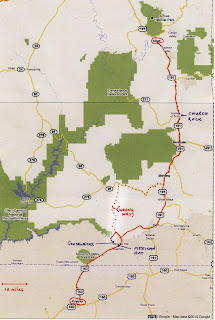
We left Gooseneck's State Park and set off for Moab on Highway 163 to Bluff, passing Mexican Hat (a pile of balanced rock in... you guessed it... a Mexican Hat shape) on the way.


Then we used Highway 191, passing through Blanding and Monticello before making it to Moab's River Canyon Lodge by mid afternoon. And then we JUMPED IN THE POOL!

Monday, 17 May 2010

Day 11 - Viva Las Vegas

So today Faith was really generous and gave us the latest start of the trip – 9am!!! This was deeply appreciated after our first night in Sin City as many of the lads (including Vicky) were busy collecting ‘top trump cards’ along the strip.


Las Vegas Strip from the Eiffel tower at Paris! Casino

Image from: http://touroncell.com/cart/images/Las%20Vegas%20Strip.jpg


Unlike most days there was no UON bombardment of the local supermarket, but instead a leisurely stroll around Las Vegas strip. The strip or Las Vegas Boulevard is around 4.5 miles long and has a habit of making things look closer than they are due to their size. We discovered this on many occasions throughout the day! As well as this compared to all of the other places we have visited before Las Vegas it was very rare that an American voice could be heard through the masses of people piling through the streets. It was almost possible that you were in another country outside of America, infact outside of reality!

Las Vegas has an attraction to people of all ages due to the activities which are available; however the mean visitor age is 47.7 years old. This was seen in the casinos where there were many old people playing the slots or roulette. This seemed surprising at first as through media, such as films Las Vegas is always seen as the city of Sin or in the case of ‘The Hangover’ a stag party location. Once in Las Vegas it is obvious that money is needed and at the end of the day what age range has money to waste?


A map of Las Vegas Strip

Image from: http://www.paylessvegas.com/img/vegas_strip_map.jpg


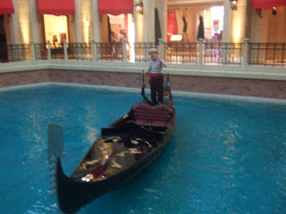
After eventually organising into groups we unleashed ourselves on the strip. First stop: the Venetian. This casino blew us away or rather, floated us away on a lovely gondola ride with a fake Italian serenading us with ‘That’s Amore’. Well, Mary-Anne and Luci did this while Danni and Scott got lost in the shopping plaza, who with their great sense of direction found the car park on the third floor instead of the exit! In fairness to Danni and Scott though the Venetian is designed to confuse you as it has a skyline inside that changes from daytime to evening throughout the day, so you are never quite sure where you are or what the time is!


Inside the Venetian Hotel where outside is inside.


Whilst on the gondola ride we were informed by the fake Italien man that the Venietian was built in place of Sands (this is what it sounded like) Casino where the rat pack always used to play concerts.


The fake Italien man on the inside gondola experience


After our little adventures in the Venetian we headed to the Mirage, which was themed around an oasis. The most amusing part of this was that it appeared that the flowers were fake as there was a lady dusting and cleaning them! However this is a sustainable approach for a city located in a desert where water is short. However, as information at Springs Preserve told us the day before, resorts are only using about 7% of the city’s water meaning that using methods such as fake flowers is helping reduce water usage even more. This is present in many areas of the strip including along the road where desert plants are being used which can handle a lack of water.


The Oasis in mirage which appeared to be made up of mainly artificial plants.


This sign was located outside resorts which were working in conjunction with the water authority.

At the Mirage you could go to the Secret Gardens where you could see dolphins and white tigers, yes that’s right dolphins and tigers in Las Vegas, where the dolphins don’t do shows they do ‘educational programmes’. This surreal experience was fantastic but at the same time quite disturbing as the animals didn’t really have large areas to live in… not compared to the size of the hotel anyway!


Entrance to the Secret Gardens where wildlife enclosure and dolphin habitat is located.


After the Mirage we decided to get some food (which was amazing!! Stuck on what to eat? Visit food hall in The Venetian!) and took a stroll down the strip towards New York New York. Luci was being snap happy, Scott was chatting up Elvis and Danni was feeling slightly alienated as she felt like she was a part of ‘A Bugs Life’ in Las Vegas because everything is so big and we are too little for the city.


Tall skyscrapers cover the strip enclosing you in making you feel similar to a bug.


By this point we started to appreciate the lazy American lifestyle of escalators in the street as our feet began to hurt, and we started to believe Faith’s wise words of ‘you will walk more in Las Vegas than you have so far on the trip’.


In street esculators to make crossing the road much easier and efficient.

Image from: http://mukerji.s3.amazonaws.com/wp-content/uploads/2009/04/dsc_0538-800x535.jpg


We eventually got to New York New York where we almost got lost in the casino as there were no maps!! It was interesting to see how bored most of the gamblers looked! Along with this gambling without an alcoholic drink in the middle of the afternoon was just not allowed. The most bizarre thing however was people smoking inside, yet another tactic to keep a person gambling for longer!


The skyline of New York New York Casino


We took a stroll round the streets of New York along with a look at the statue of liberty where we discovered the 9/11 memorial which was a come back to reality in a city built around make believe.


A quote from above the New York New York 9/11 memorial where t-shirts of service men had been layed out in respect.


After our experience of New York, which is ‘the best city in Vegas’ we started heading back up towards our hotel, which was good news for Luci and her camera. On the way we met a real life m&m and a member of Kiss with a removable tongue. (this was freaky to say the least!)

Overall today has been filled with A LOT of walking and adjusting to the fact that people do actually exist again. The Strip is mind-blowing, the size of the buildings and the themes are sensational. The tackiness and being in a make believe area in a sense, makes Las Vegas a fun place to be. Our exploration of the Strip in Las Vegas emphasised the fact that Las Vegas can be enjoyed even if you are not gambling. There are so many activities to be done and so many ‘cities’ to visit in the 4.5 mile strip that each place is a totally new experience. However when in Las Vegas it is advised that you have A LOT of money as there are so many places that entice you in and make you want to buy things, if you have will power you will be fine but if you like designer labels... well... good luck to you!


We have now crashed and burned in our hotel room and are just getting ready to go to the baseball game like true Americans... Wish us luck in figuring out all the rules!


Sound advice for visiting Las Vegas =]


Thursday, 13 May 2010

airport


terminal 2


30 minutes left.
lots of noisy dirty people in front of me.
i know them.
they have trashed this corner.
i may have to disown them now.

Las Vegas Terminal Two

After the 8th hour of sitting here waiting for the plane we have all become quite quiet...
After playing a rowdy shoe game, cards, throwing cups and botles in the bin and chanting UCN we are slowly running out of things we can do :-(
Boarding is in an hours time, most people are broke, and have spent their complimentary £15 dinner voucher (in Burger King).
We've had very wierd looks (especially mary-anne!) and Greg has finally got given the A-ok to fly home with us. Whoop!
Our new arrival time should be 4pm friday at Gatwick... Fingers crossed eh?

What would life be like without Geography!?

Love Mary-Anne and Josh

P.S. student services: i have evidence of syncronised swimming!

Zion to Las Vegas

The last drive ending at the city of sin

As the sun rose over Zion we little campers said goodbye to Utah, the towering Navajo Sandstone cliffs and stunning scenery.

What we were leaving behind :(


First stop WALMART!

This is where we all stocked up one last time before heading to the city of sin

Before entering the city that never sleeps, we took a detour to Springs Preserve (The old springs) which once upon at time supplied Las Vegas with the ever so precious H2O before it dried up and Hoover Dam took the honours. We gandered around the preserve watching videos, poking cacti and learning about the history of Las Vegas in a human and geological context.

In the Preserve there is a sustainability gallery which teaches visitors to live sustainably. Remember the quote campers.... "development that meets the needs of the present without compromising the ability of future generations to meet their own needs". (United Nations 2009)

It does this through interactive methods allowing all ages to participate in the learning experience. The things this includes are a video in a recycling truck and a driving experience whereby you can learn about how unsustainable cars are and the more energy efficient alternatives. Also one other thing we got excited about (well Emma did anyway) was the sustainable house and the fun ways of adapting your house to be sustainable. Our fun was cut short as Greg demanded (politely) that it was sadly time to leave.

The cool dustbin cart

A few interesting facts we learnt today:

• Las Vegas is Spanish for “The Meadows”
• Population of the Metropolitan District of Las Vegas is 1.95 million.
• Hoover Damn was built in two years and to those who have seen this immense mount of concrete can appreciate the ingenuity and hard work that went into this construction (Video in Ori-Gen Centre).
• 2 million gallons of water are conserved in Las Vegas each year
• 90% of Las Vegas water comes from the Colorado River

Upon exiting the old springs, Duncan decided to fuel up as Janet watched by forgetting that she had even less fuel than Big D and thinking that singing in the mini bus would make things all right. As Janet lagged behind students were thrilled at the opportunity\embarrassment of pushing a FORD minibus down the strip for all to see. Meanwhile bus 1, 93 and…… Chris's, were marvelling at the sites with their heads bopping and cameras flashing as they rolled down the strip in style (with fuel in their tank). Left to our own devices we entered the Flamingo Hotel and after writing this blog we are now ready for what the night has to offer.

The Flamingo Hotel that we are staying in certainly has a lot of history surrounding it. It first opened on New years Eve 1946, and its owner was none other than the ganster Bugsy Siegel. However it has been completely rebuilt so nothing remains of the original hotel/casino. The hotel is on the larger side with a huge 3,626 rooms and a large casino to match (Vegas.com 2010)

To sign off we leave you with this inspirational lyric from the Big man himself; Elvis Presley……VIVA LAS VEGAS!!!!

Emma, Rachael and Alice

References:
United Nations (2009) Report of the World Commission on Environment and Development: Our Common Future [online] Available from: http://www.un-documents.net/wced-ocf.htm [Accessed 16th May 2010]

Vegas.com (2010) Flamingo Las Vegas [online] Available from: http://www.vegas.com/resorts/flamingo/ [Accessed 16th May 2010]

Sunday, 9 May 2010

After a most excellent day off in Moab, which included rafting on the Colorado river (yay!), horse riding (Em, her horses name was Chism) and excessive drink (Tris and Jonny), we left at 6am (much to the boys dismay). Heading out of Moab and starting our long journey of 266 miles to Bryce Canyon National Park, we stopped off at Capitol Reef National Park.

Capitol Reef National Park


On arrival here, we headed straight to the the visitor centre to pick up our junior ranger programs and attend the "Watermark" orientation video, all about the formation of Capitol Reef.

Physical Geography

The video was very informative on the formation and continuing development of Capitol Reef. The waterpocket fold defines what the national park is. It has been 519 million years since the uplift of the colorado plateau, caused by the destructive plate boundary between the North American plate and the Overlying Pacific plate. This caused a monocline, "step" in the rock formation, with rocks overhanging lower levels, creating a fold.
The Waterpocket fold however formed around 50-70 million years ago, and is so named for the continuous erosion of the different layers (stratifications) of rock. It forms when water erodes away rock forming a basin.
In Capitol Reef, these basins are very common in the fold, giving it the name Waterpocket Fold.

One of the most famous parts of Capitol Reef are the Fremont Petroglyphs found on the rock face walls. The Fremont Culture lived there from about 700 until 1250.


Tourism
Capitol Reef National Park presents huge domes, spires, monoliths, twisting canyons and arches. All these scenic natural features attract tourists all year round. Capital Reef National Park has a visitor centre which has a gift shop selling souvenirs, a museum for people to learn about the history and wildlife of Capitol Reef. Also there is a theatre which provides a vital resource for teaching tourists about Capitol Reef, how it was formed, what there is to see such as pictographs and mazes etc.
Capitol Reef is open all year round there is a campground and sources such as food stores, gas stations nearby. A Junior Ranger badge can be achieved by tourists by learning about the area and completing a workbook full of tasks. Guided trails are offered and you can pick fruit from the orchids to eat there or pay to take some away. There are scenic drives available, lots of hiking trails, bicycle routes and scenic views all round available to tourists.

Resource Management

Capital Reef National Park integrates, like most national parks the use of all natural, historical and cultural elements whilst being as sustainable and economical as possible. Part of this is the Junior Rangers Guide, within the guide it tries to educate the Junior Ranger on how to keep the park clean, giving information on how dangerous cigarette butts and rubbish is to both the animals and environment within the park.
Also Capitol Reef only waters one section of its park, the rest is down the natural movement of the elements, this watering occurs at the Orchards, the Orchards are part of Capitol Reefs history and heritage, with settlers starting to grow fruits there over 100 years ago.
Federal Law decides that all natural, historical, archeological and cultural resources are protected and that there is a hefty punishment if this law is broken.
Other resources within the park are picnic areas, restrooms, drinking water and specified grills cutting any hazard of excess waste and fires, with extra fees for the Orchards and camping the Park makes money to keep its maintenance at a high standard looking after all the features within its boundaries.

Bryce Canyon National Park

Then it was on the final leg to Bryce Canyon National Park. This park was the highest one we visited, at 9600 ft.

Physical Geography

Most of the Canyon is made up of landforms called "hoodoo's". These were formed from fins which developed during the process of uplift of the Colorado plateau and the fracturing of crust. The "hoodoos" are made up primarily of Claron Formation which is a silty and sandy limestone. from the uplift, vertical cracks (joints) were made. These joints were block fins, and were weathered first, forming cracks in the fins. The more resistant layers of rock protected the softer rock from weathering. The harder Wasatch limestone formation left horizontal ledges as the fins eroded. The fins disintegrated due to excessive erosion, which left behind slender remnants of the original block of limestones. These remnants are testimonies to the work of water in the arid landscape that is Bryce Canyon National Park (display at Bryce Canyon National Park visitor centre museum).

Tourism

Bryce canyon National Park offers visitors grand views from the eastern edge of the Pausaygunt Plateau in Southern Utah. The visitor centre is open all year round, with a natural history museum and gift store. A video program is shown daily in the auditorium teaching people about how it was formed and information about the area. There is a rustic style dinner open from april to october. There is a general store, guided and self guiding tours and horseback tours available. There are a variety of hiking trails and lodging available. Camping grounds are available and Bryce Canyon Spectacular scenery to keep attracting tourists.

Resource Management

Bryce Canyon adopts the same attitudes towards its natural, historical and cultural features just like any other national park and just like Capitol Reef it does everything within its power to provide a good, safe and sustainable environment for its visitors, this includes among others a shuttle bus run. Using a shuttle bus run can cut down on fuel consumption, pollution and the building of anymore unnecessary car parks.
Other resources at Bryce include trails for cycling, hiking and walking to really open up the experience for its visitors whilst being as environmentally friendly as possible to stop any damage being done to its features. Also covering religious services due to the historical Mormon heritage and holds services at Bryce Canyon Lodge.
There is an RV park so visitors can stay on their own accord and shower and laundry areas which also provide a useful yet sustainable service for anyone involved.

Personal Reflections

I thought that it would have been nice to actually have seen more of Capitol Reef as we did not really walk around or see much of the National park, although we had the debate there which was interesting. Bryce Canyon was the best part of the day with amazing views and a nice walk down into the canyon and back up. Although we did miss the chance to get a Junior Ranger badge due to someone messing up the times Greg.

Although we did not have a lot of time at Capitol Reef we were able to have a debate on the effects of tourism on nearby town Moab, this was educational and fairly fluent for most involved becoming heated at times with both opinions and facts having its fair share. At this point I had removed the pen from my face, after Kate the ranger had seen it.
Bryce Canyon like everything else that has been seen on the trip was amazing to see and had interesting history and geological facts, although there probably could have been a little more to be learnt there.

Day six

After a fairly early start a stop at the local supermarket to stock up on our junk food was appreciated.
Greg however was more concerned with providing his bus with card and pencils to make flags and posters to compete with Janet’s amazing Jack“son” and Daughts team spirit. (bit of bus jealousy we think!!)
Greg did admit however that his may not be the best but it is always number one!

After a short drive we arrived at Arches’ national park for a day full of fun packed work. Our mission was to find out how the arches where formed.
To help us find this information we spoke to Park Ranger Lori. Although there is no single way that arches are formed it is manly done by chemical and mechanical weathering.
Mechanical weathering is where water enters crakes in the rock, freezes and expands putting pressure on the rocks and enlarging the openings.
Chemical weathering is where water enters the Slick rock which gets stops by the Dewey bridge rock. The acid in the water erodes away the weaker sediment and the arch is formed

Picture

We also went to view a video on how the arches were formed. Silly Clare however forgot lights went off in movie theatre and fell over the stage lol! We think she should have got the silly badge.

Back on the buses and a short trip up a hill we went to see the north and south windows of Arches national park.
Boys will be boys and decided to climb on the rocks making it a competition, as who can get the highest. This then made them reinact the Lion King!

Picture-lion king

The group then split into two. The more adventurous students went to see the delicate arch which was a hard hike. Where as we decided to take a leisurely stroll to landscape arch.
The toilets where a pretty sight.(not!) Everyone thought the toilets where broken as they didn’t flush. But Faith reminded us they where only pit hole toilets so wouldn’t flush! (I would hate to be the person to clean them out haha!) But to be fair they smell better than most.

We started our relaxing walk and arrived at landscape arch. Was beautiful but slightly scary as previously in 1991, a huge chunk fell off. This means now you can no longer walk under it, and only observe from a distance.

While we where here we did the junior ranger task and had some lunch. We soon found a little friend (fury kind)
On the trip back the group got separated, with everyone a bit lost. Mary-Anne’s hat made a break for it, with Janet slow running after it, soon giving up for Vicky to get.

The next stop was back to the visitor centre to get another Junior Ranger badge. A very proud moment!

Soon back on the bus again to Moab and our hotel for everyone else to leave and do another Adventure tourism activity, while we write this sitting by the pool.
Good times!!!

Vicky, Sam and Clare

Day 9 - Zion National Park


ZION NATIONAL PARK

Zion National Park is a short two hour journey of 83 miles traveling south west of Bryce Canyon along Highway 89, until we reach Springdale, Utah. Zion National Park covers 229 square miles of protected area, with a thriving wildlife and large diversity of plant species inhabiting the area, Zion National Park is a very diverse and interesting place for tourists to visit.

People have inhabited Zion for over 12,000 years, originally inhabited by the Anasazi, whom moved on due to environmental conditions. In the 1860's, after an initial visit to Zion by John Weasley Powell, Mormon pioneers began to settle in the area. With the Mormons actually naming Zion; meaning 'place of quiet sanctuary'. Formed initially through uplift and undercutting of the Virgin river, Zion began to form the outstanding features that can be seen today; rock formations, the canyon and the plateaus. In 1909 Zion Park became a National Monument, and just ten years later, in 1919 it was granted National Park status.

MISSION STATEMENT FOR NATIONAL PARKS

“…To conserve the scenery and the natural and historic objects and the wild life therein and to provide for the enjoyment of the same in such manner and by such means as will leave them unimpaired for the enjoyment of future generations...”

An act of congress to create the national park service, Aug 1916


Zion National Park maintains the mission statement set out by congress in a variety of ways; most importantly it is one of the leading National Parks for sustainable tourism. Zion has strategies in place with almost all activites relating to the site, making every effort to limit environmental and cultural impacts of tourism. Some of these strategies include: a shuttle bus system, recylcing facilities, water bottle filling stations and the use of Trombe (including solar panels) to power the lodge.

The range of activities on offer at Zion appeal to a range of tourists; eco-tourists, environmental tourists, geo-tourists... There is something on offer for everyone. The physical features of the area which have been formed over thousands of years (initially from undercutting, then erosion by the Virgin river) offer a view into the entire landscape of the south-west. The layer of rock visible in this area is the Navajo sandstone, which is the youngest layer visible of the Grand Canyon. However the landscape is everchanging; In 1994 there was a landslide resulting in not only a section of the road to Zion being cut off and the park being shut for six weeks but it also led to a dramatic change to the landscape. Evidence of this can still be seen in the form of large boulders on the river edge, however much of the landslide has been since eroded and transported downstream by the Virgin river.

There are a number of trailsnot only leading to visually awesome scernaries, but also interesting geological formations, at a range of fitness levels. By following the Emmerald trail, you reach a number of naturally formed pools, each being inputted by a waterfall falling pituresquely of the local rock formation.

One of the key activites that Zion offers, like all other national parks, is the opportunity to be educated about the sourrounding environment. The junior ranger scheme offers the chance for young (and old) to learn about the park, and how they can help to retain the area and limit their impact. As part of this, the museum offers the opportunity to learn about the geology and history of the area. Rangers are also regulary on hand to help assit in further understanding of the area.

Hannah: "In my personal opinion, Zion was one of my favourite places visited on this trip so far. Even though the Grand Canyon was awesome, there was something untouchable about it. At Zion, the trails allowed you to access all reaches of the park, experiencing a variety of different features (the presence of water and vegetation was a nice change!). By going along the Emmerald pool trail, we were able to witness the beauty of a waterfall cascading into a pool of water tucked away up a trail. The way it was hidden yet accessible gave it a sense of a very magical place, different to its other surroundings with a beach, pool and rocks."

Josh: "I have been looking forward to visiting Zion all throughout this trip and it did not disappoint! You get a completly different perspective to other National Parks; whereas in the Grand Canyon and Arches you are looking down into the park, Zion lets you into it's secrets. It lets you feel, smell and hear things you couldn't in many other parks. After the desolation of the desert in the surounding area the vegetation makes a beautiful change. The scenic drive into Zion adds to the experience, when half way down into the park a view of the road winding through mountains gives you a sense of energy and inspiration."

Aaron: We believe that Zion was one of the top National Parks to go. It offered outstanding scenery that would literally take your breathe away. What makes Zion so spectacular was the distribution of trees in the surrounding area of the trail. The Emerald Trail in particular was incredibly impressive in that it offered a new water based pool at each stage of the walk. As you ascended up the route the pools grew and were more outstanding than the previous. Once you reach the top pool you are met with incredible views and scenery near and far. At the top there is a monumental view of a waterfall above you when standing on a beach. Despite it being a strenuous walk it was definitely worth it!!

Saturday, 8 May 2010

Day 3 - 03/05/2010

3rd May 2010 – The Gut Busting Grand Canyon and its Trails


The Grand Canyon is merely a stone’s throw away from any tourist hotspots such as Flagstaff which has hotels, restaurants and historic attractions to cater for all needs and requirements. A good starting point is to take in the breath taking scenery from the visitor centre viewpoint. Next port of call before you proceed any further should be a ranger’s talk within the confines of the informative visitor centre itself. This talk on the geology of the Grand Canyon is not only educational but also entertaining and easy to listen to and understand. You should listen with open ears whilst the ranger is talking, due to the fact that the exposed environment lacks signs that illustrate the natural beauty that is all around you. With great beauty comes a slight risk, therefore a minimum of 4 litres of water should be taken, along with some food when tackling the trails.


A Map of the Grand Canyon Trails, including the Kaibab Trail


There are many routes around the canyon that can be taken and the easiest access by shuttle bus is the challenging Kaibab trail. The bus driver is not only exceptional at his duties as senior coachman but also very knowledgeable and helpful in the terms of information about trails and general Canyon facts. When you arrive at the start of the Kaibab trail one can’t help but be overwhelmed by the natural beauty and presence. The trail is a fantastic chance to get photos so it is good to take your time on the way down, taking in the spectacular views because the way back up is easier said than done. Mainly tackling the trail is a mixture of school visits, enthusiastic tourists and hikers, who are all friendly, easy to talk to and will help to keep you going when the trail becomes tough. As walking down the trail the transition of the rock types that the ranger spoke about earlier becomes clearer as you descend deeper in to geological time. During the trail there are ideal places to sit and look out into the truly ‘Grand’ Canyon and if you are lucky you may spot a huge California Condor soaring on the thermals above. At a gentle two and half miles you come across Cedar Ridge which is a perfect spot to stop for some food, use the restrooms and take in the scale of the Grand Canyon, however whilst eating you must be careful of the cheeky Kaibab squirrels that may fancy a spot of your lunch.


If you are a more driven walker then carry on further to the spectacular Skeleton Point where you can see down in to the river channel canyon. Keep an eye on your watch because the route back up is more time consuming then the decent. Taking regular breaks to top up on water and air is strongly advised as is the topping up of sun cream. When you reach the top again you have a real sense of accomplishment when you look down the canyon and see how far you have walked. If you still want more of the views then getting off a stop before the visitor centre is a good opportunity to enjoy the delights of the relaxing rim trail. This takes you along the stunningly beautiful South Rim and this walk mixes views of the different native trees and flowers alongside the awe-inspiring views that the Grand Canyon has to offer. This tops off a breath-taking day at one with nature at one of the world best natural wonders.


Muchos Love. Matt, Luke and Freddy

Day 4 - Grand Canyon, Tusayan ruins and Dinosaur tracks


Description of location: Grand Canyon; Arizona, Tusayan Ruins; GC, Arizona and Moenave Dinosaur tracks; just before Tuba City, Navajo.

Aspects of geography going to talk about: Tourism, Resource Management and Physical Geography.


Map showing the Grand Canyon; Arizona and the Navajo Indian Reservation


Tourism

There are many forms of tourism; the ones that will be discussed are sustainable tourism, economic tourism, educational and adventure tourism experienced during the day.

On day two at the Grand Canyon some of us woke early to watch the sun rise at Yavapai view point. This view point gives tourists the opportunity to watch the Grand Canyon go from darkness to light with amazing light rays and shadow during the rise. This point is in a great place for this to happen. Information about the daily sunrise times are located in the visitor centre and leaflets given on arrival to allow tourists the option of doing this. After this we went on to do the Bright Angel trail.


The Tusayan ruins came next on the day’s activities; these could be seen by walking along a path past the Gathering Loop, storage area and living quarters. At both the Grand Canyon and the Tusayan ruins there were sufficient car parking areas and restroom available and accessible for all.

Finally we visited some dinosaur tracks in Navajo on the way to our motel in Kayenta. These were not as formal a places as we had been travelling around, however they were interesting and the people there seemed to know how to market there rare tourist experience.

Adventure Tourism

Grand Canyon - involved walked the Bright Angel Trail. This is the most popular trail into the canyon. It is a gentle walk offering plenty of shade. These factors enable the trail to be accessible for the majority of tourists which is possibly why it is so popular. The trail starts west of Bright Angel Lodge. Like the other walks the first Rest house on the trail is 1 and a half miles down. If you were an adventure seeking tourist then you could hike to the 4500ft to the bottom of this trek ending in Plateau point (12.2miles). However even for the most thrills seeking tourist it is unadvisable to walk up and down the canyon in one day. We on the other hand only walked a very little bit as were all hiked out after the Kaibob trail the day before.

The elevation of the Bright Angel starts at 6900ft so tourists with chest of breathing difficulties should take it slow and everyone needs to keep hydrated. If this was thought to be a problem then there is the option of going on the trail on a mule. We didn’t participate in this, however whilst we were walking down the trail a group of mules were returning to the top.


Educational Tourism

Grand Canyon - this involved us finishing off the Junior Ranger program. This is designed to keen children engaged and attempts to get them interested in geography and geology. This also includes generally looking at information boards and leaflets on the trail.

Tusayan Ruins – this was in the form of information boards around the path area displaying what everything was and how it was used 800 years ago when the Tusayan’s were inhabiting the area. For example, there was a big sage bush which uses included boiling the leaves to make dye and using the bark to weave baskets. Educational tourism also was apparent in the museum displaying artefacts and with guided tours.

Dinosaur tracks – no signs or information boards here, however the people who run this small business seem to know there stuff. Although the dinosaur footprints were real they do exaggerate what they have on offer by creating a story around them to enhance the tourist experience. For example they told us the prints were from common dinosaurs and they had planted eggs and bones to keep the illusion going.

Sustainable tourism

Grand Canyon - To make what we did more sustainable environmental wise the park could limit the numbers of people that trek this at a given time and over the course of the day as it did get quite busy which for some people spoilt the experience slightly. Litter bins are not provided on the path, however there are plenty at the rim and judging by the cleanliness of the area tourists are making use of the bins and not ruining this wonderful landscape.

Tusayan ruins – this area was sustainable as you couldn’t walk on the actual ruins but around a path, therefore preserving the area for generations to come. There were also litter bins and ashtrays at the entrance encouraging tourists to be kind to the environment. In the museum and at the entrance there were also signs to encourage ecotourism. The place was very clean so this is obviously working. Some areas were cornered off while we were there as revegetation work was occurring.

Dinosaur tracks – these were not very environmentally sustainable as we were as tourists allowed to walk over them, however this is probably the only way they could do the tour at all as they don’t have finances or backing to manage it any other way.


Economic tourism

Grand Canyon – this here included paying for the hotel, which incidentally was the most expensive hotel of the whole trip. So long as this money goes to the upkeep of the National Park that’s ok. This also included for us paying to enter the National Park, food shopping, eating ice cream, shopping in the tourist designed shops for souvenirs and for some paying $15 to the area for phone cards that don’t work……but hey maybe they’ll buy an air freshener for the toilet at Ceder ridge with that money! (There’s always hope)

Dinosaur tracks – this isn’t marketed as economic tourism as there is no fee to see them, however it is courteous to buy some of there jewellery or leave a donation. We decided to buy bracelets that were $8 each for 2 for $10. however if they were to charge at least the money would go directly to them as apposed to be eaten up by finances if they were taken over by a National Park or Government organisation.

Overall, the tourism varied from place to place with not every place offering the same types of tourism. The Grand Canyon offers more adventure tourism, and the ruins and dinosaur tracks almost being historic tourism. All sites provided educational aspects and need tourism to survive!


Resource Management

How do you preserve something so delicate and beautiful so that we, the current generation can enjoy it, as well as future generations?

In America, the Department of the Interior (DOI) is dominantly responsible for the management and preservations of resources, especially those associated with the use of public land. The Grand Canyon is a national state park, where as the Navajo Nation which we drove through, and Moenave Dinosaur Tracks are not designated public lands.

The Grand Canyon
Within the National Park of the Grand Canyon, resource management is taking very seriously. There is a highly recognised ranger programme (including junior ranger which we all got the badge for yeas!) In the desert of the SW USA, resources can be hard to retain, such as water. The Grand Canyon stores water, the amount for three days usage, in case the springs do not supply water is kept as a reserve. With out water many of the facilities would not be able to function, then causing a strain on other resources, such as food and restrooms. (Not all restrooms have running water though!) Environmental areas of re-vegetation had also been established to allow species of plants to be undisturbed by animals as well as humans.

Tusayan Ruin’s are managed with in the Grand Canyon, leading to a ranger being present at the site, and educating through talks and visits amidst the ruins. The resources are managed as the same to the rest of the park, and are also being developed with the increasing numbers of tourists.

Picture of Grand Canyon!

The carrying concept of the canyon (O’Reilly, 1986), looks at the amount of people in which an area can uphold. At the Grand Canyon, the capacity is always being reviewed, with constant development of facilities, thus developing the management of resources and how to keep the park running.


Moenave Dinosaur Footprints
Navajo Nation displayed a very different resource management in the attractions that were on offer. At the dinosaur footprints, the actual foot prints were not protected from the human interference (as mentioned above), leading to a poor management of land. The resources available at this location were also limited, no rest rooms or water were available, although jewellery was driven to the site to be sold.
Picture of Navajo Nation!!

Physical Geography

In context to the Grand Canyon and Navajo Nation, the physical geography is plentiful and able to be seen everywhere you look from geology to cloud formations.

Geology of the Grand Canyon
The geology of the Grand Canyon is one of intense diversity with rocks on display that date back over 2 billion years yet carved by wind and water over a period of only 5 million years. The rock strata on display shows many different periods of geological time and show constant periods of dryness and periods when the whole are was a shallow sea. One the day the group could only get down to the first two layers of the many that are present and they are the Kaibab limestone and the Toroweap formation. The Kaibab limestone’s where laid down when the area was covered by a shallow sea and the sand and sediments at the bottom where compressed until they turned into sedimentary rocks. This is evident by the presence of small marine animals that are present as fossils in the rock layer and also the presence of marine sands that the fossils are buried in. The stone is very crumbly and turns to sand very easily when broken down by wind or water and this makes it very easy to erode which happens on a regular basis. There are also large amounts of sandstone mixed in with the limestone and this also shows that there were coastal processes in evidence as the sand would of have to come from the coast as well as the sediments from the bottom of the seas. The second observed sediments was the Toroweap formation which is similar to the Kaibab as the sediments are similar but the Toroweap shows evidence of more sands than the Kaibab and this was probably dune sand coming in from onshore and being deposited at the mouth of a larger river of in the basin of a shallow sea. These two layers are concurrent with the known history of the area as that area of America was underwater during the Permian era when they were laid down but the seas where retreating which is shown in the rocks by the presence of more and more sand as the layers progress.
Picture of layers!!!!

Navajo Nation

The rocks in the Navajo nation are very similar to those at the Grand Canyon but with one important difference and this is the presence of dinosaur fossils. Theses where laid down in the early Jurassic when the area was many braided rivers flowing into the sea about where the Rockies are today. Theses river sediments allowed for very good impressions of footprints when a variety of dinosaurs walked across them and these where then covered by more sediments. Millions of years later they have been exposed by a combination of erosion factors both wind and water based and they have now been exposed to the wonderment (and scepticism) of many generations of university students!

Personal reflections on day
Very good day, watching sunrise and the sunset was awesome over the Canyon. The trail was a nice relax after the day before on the Kaibob. The Tusayan ruins were a good example of how America’s history has only just started to be preserved. Finally the dinosaur tracks were interesting as it brings a normally hard concept to comprehend (the fact dinosaurs existed) to life as there is clear evidence. The contrast between a national park and the Navajo nation was rather distinctive.

From reflecting on the day through this blog, it is evident that all three of the field trip themes are both clear and also inter-link with each other.


p.s. were all safe and having a wiked time :D


much love, andrew, cat and mary-anne
Tuesday, 4 May 2010

Day 3 Grand Canyon Yo!

Day 3 Grand Canyon 03/05/10
Katy, Adam & Katy


Hey Fans!
Today we visited the Grand Canyon!! It is situated in north west Arizona, south west USA spanning 277 miles long, 16 miles wide and 1 mile deep.

Jim, the park ranger, took over enthusiastic (and quite creepy) joy in lecturing us on the formation and geology of the Grand Canyon. So we better inform you guys, because it’s AMAZING!

Firstly, let’s get one thing right, it may not be the only Grand Canyon in the world, but it is THE Grand Canyon – From the man himself, Jim.

Here we are listening to the ranger talk for 30 minutes about Spongebob Squarepants and his nose picking baseball days in 1955:


Although not the deepest canyon, or the widest canyon or the longest canyon in the world, it is the deepest longest widest prettiest canyon. Jim taught us four words to remember the Grand Canyon:

Enormous Proportions, Colouful Scenery.

For those of you who can’t remember that, try remembering the words 'large' and 'pretty'. Jim talked us through the geological time frame of the Grand Canyon and how it is 1.7 billion years old, which is ‘the blink of an eye’ in earth history. The Grand Canyon contains clear distinctive layers in the rock highlighting these different geological time periods, starting with Kaibab Limestone at the top, all the way through different strata to Vishnu Schist at the bottom. Most rock forms were created in shallow tropical oceanic marine environments that were originally a desert. Jim said ‘water can cause a lot of damage in deserts, proved by the Grand Canyon.’

The Colorado River deepened the Grand Canyon, exposing strong and weaker rock, causing walls to collapse and the canyon to form. These minerals created different colours in the rock exposures indicating the different time periods.
Another Park Ranger (from YouTube) once taught us about D.U.D.E
Deposition Uplift Displacement Erosion
Another way of learning about the processes involved in making the one and only Grand Canyon.

For you 'humans' (geographers joke), resource management and tourism are important in the National Park. The Grand Canyon National Park, from our experience today is well managed. The park draws a whole range of international and national tourists, contains facilities that cater for everyone (there is even a trail suitable for wheelchair users) and the park also encourages eco tourism through recycling and solar panels.

Resource management at the park is signified by its many signs telling visitors not to feed the animals, step to one side for mules, keep to the tracks etc. The recycling bins, although not on trails were available at the visitor centre and rim areas. Solar panels were used to create electricity for the buildings, and water used was pumped up from the Colorado River.

The Junior Park ranger scheme improves tourist experience and knowledge of the park, with activities to complete and a ranger badge to gain. (Which all 29 of us achieved- including the ‘legend’ that is Dr. Greg Spellman) -> Do we get an A now Greg?

This was our first view of the Grand Canyon, it’s big.


Here we all are at the Northern rim, just before heading out to Navajo Nation:

OMG! You are not gonna believe what just happened, here we are blogging away when the laptop froze. It’s all your fault, we tried to get a map from Google for you when it froze, so forget it, there will be no map. We even had to wake up Greg (pink pyjamas on Greg is not pretty!)

Anyway...
Although we have provided photos, no picture you will ever see will compare to the real thing. You can’t capture its, beauty, scale and geological formations. You have to come and see it for yourself!

To finish our blog we wanted to share our most prized experience at the Grand Canyon, the Kaibab Trail. We chose the steepest, hardest, life threatening trail down into the Grand Canyon. Despite Faiths warnings about needing 4 litres of water, high energy foods (trail nut mix) and factor 60, we survived the hike! The walk down was amazing, the scenery was spectacular and every turn was photo worthy.

The CLIMB back up was strenuous to say the least, but extremely rewarding. Practically on our hands and knees we sweated, bled, and burned our way back to the top in the thin air that was provided. Bed by 10.30. LOL

Peace out. (Stink one).

Bare Loves. Katy, Katy and Adam. J

USA Day One. Sarah, Sara and Faye


Day One: Henderson, NV to Flagstaff, AZ.

After a fresh early morning start in Henderson, NV, the first day of the trip began, heading towards a small town called Flagstaff, AZ. En route, we stopped at several places, such as the impressive Hoover Dam, Kingman and Sunset Crater National Monument.


Figure 1: Locations visited on Day 1 of the field trip (Google Maps, N.D).


Hoover Dam

The Colorado flows 1440 miles almost to the mouth of the Gulf of Mexico from Colorado State. The water from the Colorado feeds places such as Las Vegas and Los Angeles.
The Control of the designation of water to the different states, cities and towns was controlled when the Hoover Dam was built in the 1920s.


Figure 2: The Hoover Dam, Lake Mead, NV.


A trip to the Hoover Dam allows the visitor to see how the water supply in SWUSA is controlled.
It also allows spectacular views of Lake Mead where points are set aside to admire these.
There are also trips over the Hoover Dam by plane and helicopter that allows the visitor to take in the full scale of the beauty and resource management.

It also shows the trouble that the water resources are in due to the bleaching of the reservoir bank where the water has previously been at this level.
The emphasis at the Hoover Dam is on Goetourism and Resource Management, all the activities and sights are to show the visitor how the water is managed and the problems the states relying on this water face. The Hoover dam is primarily centered towards tourists and not towards the local community.


Kingman, Route 66

Kingman’s main road is part of route 66 which was built during the 1920s to supply the new demand for travel due to trade and the popularisation of cars.
The road is full of places to attract and interest tourists, including a visitor’s centre, museum and plenty of gift shops to keep everyone occupied.
Figure 3: The Kingman Train!

The town does not offer much to the local people except for jobs through tourism.
Tourism seems to be the main industry and key to the town.

The two places were very tourism centred and were very welcoming, however for a more real experience I think we would have to integrate into society. I thought the Hoover Dam was a little disappointing as there was not much to see and was not as large as I thought it would be.

Sunset Crater National Monument.

Sunset Crater National Monument is located within San Francisco Volcanic field in northern Arizona, located close to the historic town of Flagstaff.


Figure 4: Sunset Crater Cinder Cone, AZ.


Made a National Monument in 1930, Sunset Crater is a cinder cone and was believed to have last erupted around 1000 years ago. The protected area is maintained by the National Park Service. More can be read about the National Park Service and their role at Sunset Crater here : www.nps.gov/sucr


A number of geographical themes can be associated with Sunset Crater. The Physical Geography can be appreciated by a trip to the visitors centre, where park rangers and lots of information are available at your fingertips. The trail around the Bonito lava flow is well worth the trek, as you are able to admire first hand Cinder cones, miniature volcanoes and lava flow, which are all a product of the volcanic activity which has happened in the geological past.

Geotourism can also be associated with the park as a walk around the national monument or the visitor centre may highlight and interest any tourists who are keen on volcanism, geology and natural history.

The National Monument also invites tourists, both young and old, to participate in the Junior Ranger Program, which is designed to educate tourists about their surroundings and why or how it formed. It also educates tourists in caring for the environment that they are in and why it is just so special that it has designated status. The Junior Ranger Program is a good example of the potential for geotourists.


Figure 5: The Bonito Lava Flow and San Francisco Peak at Sunset Crater National Monument.

On a personal note, Sunset Crater was a fantastic opportunity to experience physical geography first hand and apply knowledge which has been learnt prior to our arrival, which was a positive after an extremely long drive! The scenery was something which many of us have never experienced before and many of us enjoyed. However, the snow showers were slightly unexpected after the sunny start to the day and shorts weren't the best clothes to have been wearing!


Flagstaff

We began our journey to Flagstaff with ‘would you rather’ followed by ‘spot the beard’. The latter of the two was a slight challenge due to the lack of pedestrians wandering around the town.

We lugged our mountains of bags up to the 2nd floor (completely occupied by our group) of the Days Inn, to prepare for our venture into the heart of Flagstaff.

After we were better prepared for snow conditions we drove down to the centre of town. We waited to cross the road whilst the mile long cargo train went past en route to meet at the no loitering sign.

We learnt that the town was first inhabited in 1976 and gained its name from rowdy settlers celebrating the 4th of July by putting a flag up a pine tree.

Flagstaff is the largest town in Northern Arizona situated on the I17 and the I40.
Its railway has been its link to the east and the west of America.
The railway was first opened in 1880 when the towns population was under 200.
By 1890 other industries picked up such as hotels, bars and restaurants due to people being employed by the railway industry.

After interruptions by another couple of mile long trains and waving at the drivers, we wandered over to ‘North Side’.

Tourism picked up in the 1920s with Indian and Grand Canyon tours attracting visitors. The town is known as the ‘City of seven wonders’ due to its close proximity to National Parks and Monuments.

The ‘North Side’ of town is engulfed with old, yet newly refurbished upper class hotels such as the Monte Vista and the Weatherford Hotel that have welcomed the likes of Clark Gable.

We ended out discussion in Heritage Square which is surrounded by modern historical reminders and went our separate ways for food.